Client: Regional Council Karlsruhe, created in 2015
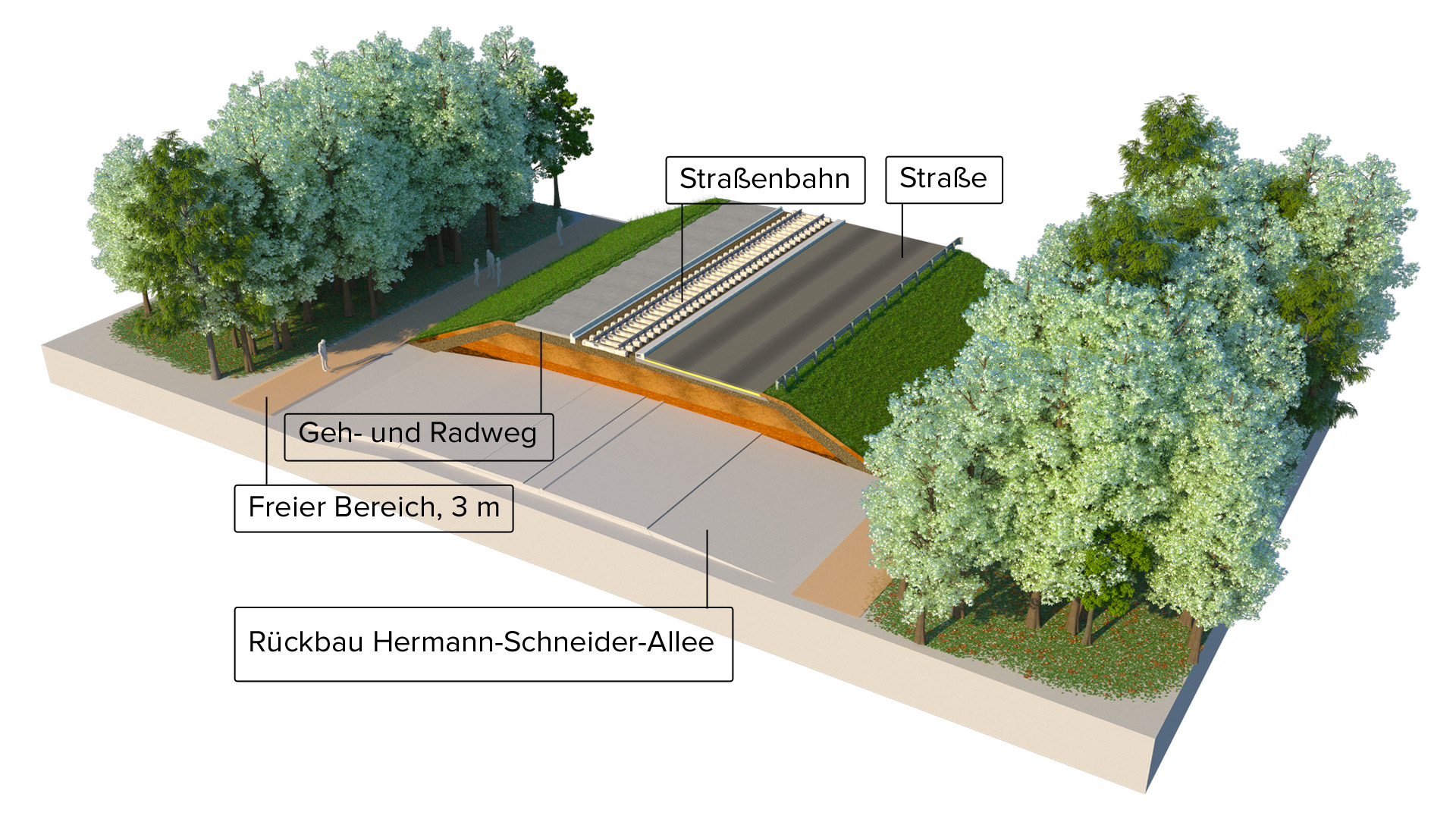
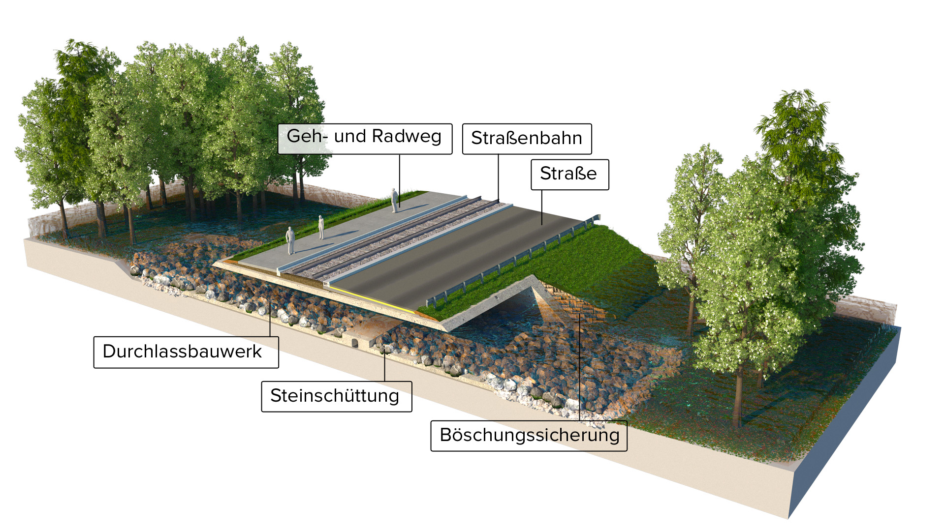
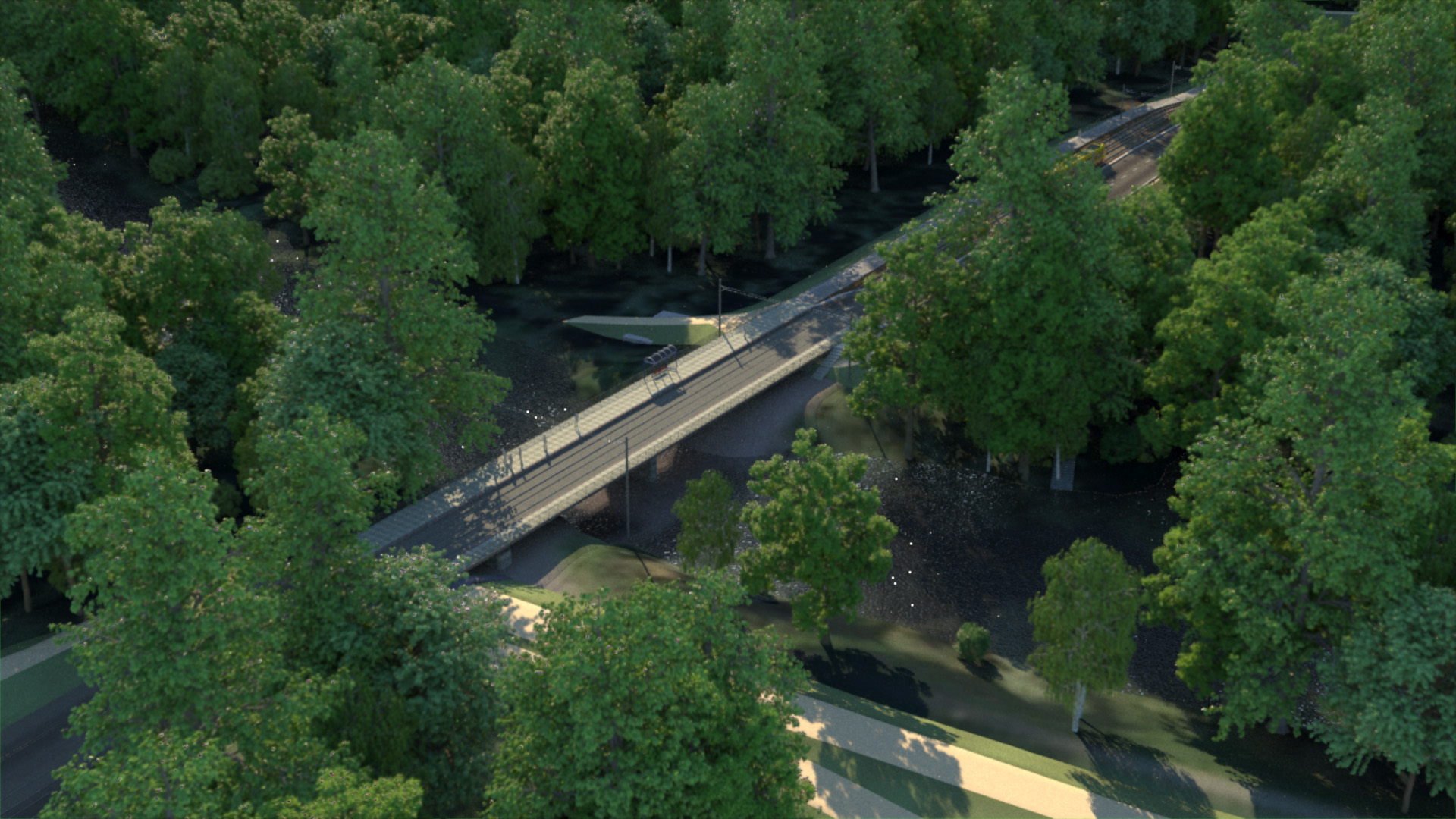
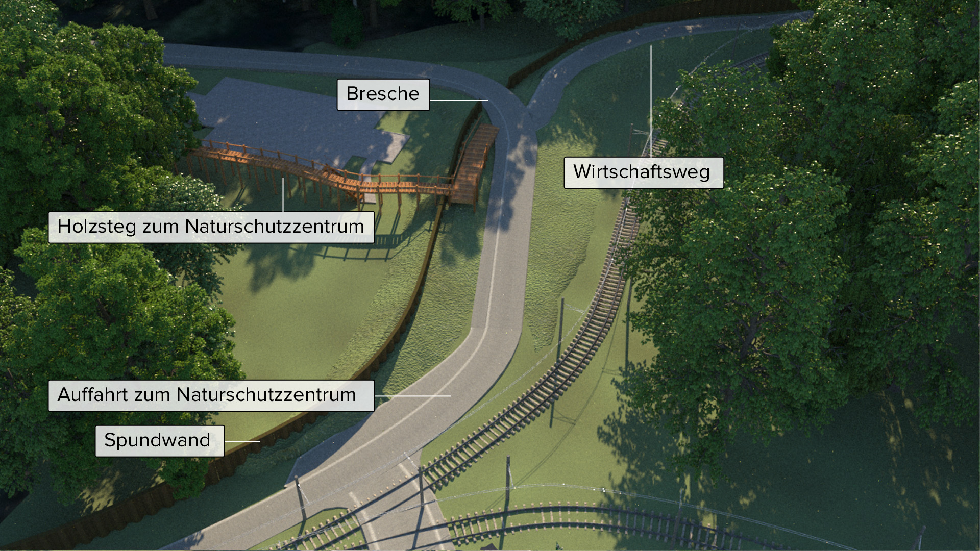
For the planned flood protection measures in the retention area Bellenkopf/Rappenwört, a visualization of the planned measures in the Hermann Schneider Avenue was created. The focal points were the elevation of the road, the reconstruction of the bridge over the cut-off meander of the river Rhine, the culverts, the underpass for wildlife, the access and exit road to the NAZKA (Nature Conservation Centre Karlsruhe) and the sheet pile at the Rheinstrandbad.
A digital elevation model, various detailed 3D models and several illustrations were created based on the 2D planning data.
By means of a tracking shot along the Hermann Schneider Avenue, the visualization shows the key points of the planned measure.